Bartin
section-f4723ef


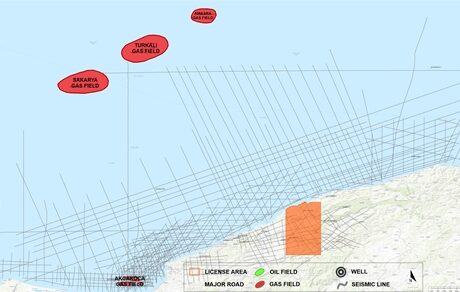
Onshore Bartın license blocks, together covering an area of 83,391 hectares, are situated in the Western Black Sea region. The main reservoir is AVO-friendly gas-charged sandstone intervals in a turbiditic sequence of the Eocene age Kusuri Formation. Its thickness varies between 500-4000m in the region. The argillaceous limestone intervals of the Akveren Formation are considered as the secondary target. Its thickness varies between 100-800m in the region. There are two working hydrocarbon systems: Carboniferous/Early Cretaceous and Tertiary systems.
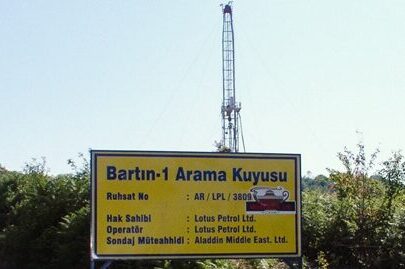
There are a total of six wells drilled within and around the Bartın licenses between 1988-2009.
The best direct analogy is the offshore producing gas fields of the SASB (South Akçakoca Sub-Basin) to the West. In the light of recognizing the similarities with the SASB gas fields, several prospects and leads have been identified based on the existing 2D legacy seismic data which were acquired between 1987 and 1989 in a sparse grid.
Although there were significant gas shows in almost all the wells drilled between 1987 and 2009 in and around Bartın licenses, none of them has resulted in a commercial discovery.
In 2020, the Sakarya gas field was discovered by the Tuna-1 well which is 100km North of SASB, and the field has been developed by drilling additional wells since then. With its 710 BCM (25.1 TCF) gas reserve size, Sakarya field is the largest gas discovery in the country. This discovery proves significant volumes of natural gas generation from the source rocks and could certainly be transformational for both offshore and onshore extensions of similar gas plays in the region.
AME is seeking a new partner to carry the costs of new seismic/non-seismic surveys and drilling one exploration well to a total depth of 2500m to test gas potential in both Kusuri and Akveren formations in return for a 50% non-operated stake in the Bartın all exploration licenses. The size of the new seismic data acquisition is subject to negotiation. The farminee will cover all costs for year one, with no back costs, and then will be responsible for its percentage share in the license thereafter.


