Zeynel-Nemrut
section-f4723ef
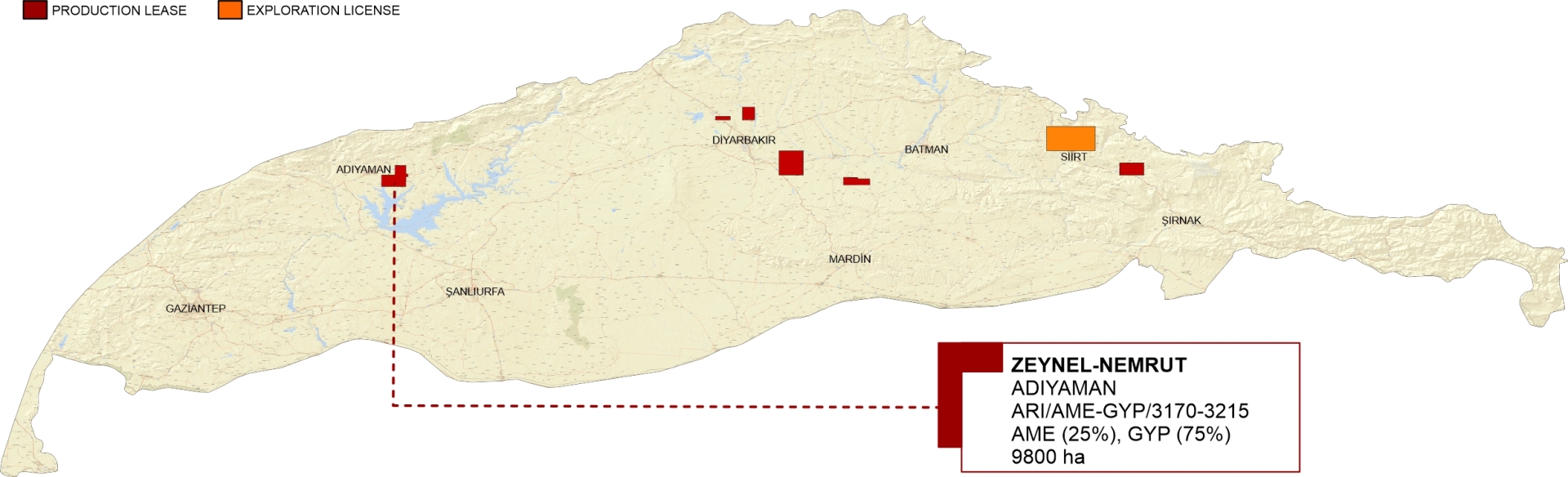
Zeynel-Nemrut oil field is located to the west of the SE Anatolian Basin in the Adıyaman province and covers an area of 9,800 hectares. It is surrounded by major oil fields; Çemberlitaş and Adıyaman oil fields to the NW, Karakuş and South Karakuş oil fields to the NE, and Kahta oil field to the SE.
Zeynel structure is situated in the transition zone between the foothill belt and the foreland. It is an elevated dome-shaped structure slightly elongated in the SE-NW direction and bounded by major faults to the South and the East. The subsurface presence of this anticline was very well documented by 13 different vintages of 2D seismic data in varying acquisition parameters.
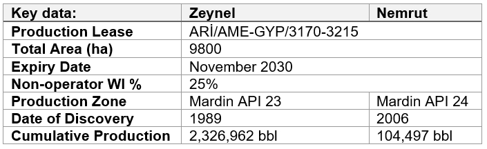
Zeynel-Nemrut oil field was discovered by AME in Zeynel-1 well in December 1989. The well was drilled to 1,500m and Karababa-C member was completed. To date, 23 wells have been drilled in the Zeynel oil field, 5 wells in the Nemrut oil field, and 4 wells in the Hasancık oil field. The average drilling depth for the Zeynel wells is around 1,500m. Most of the producer wells were completed with an open-hole casing design.
Nemrut structure is located to the SE of the Zeynel oil field. It was first discovered by Nemrut-2 well in November 2006. It is on the extension of the larger Zeynel structure.
Upper Cretaceous Mardin Group carbonates, Karaboğaz, and Sayındere formation, are the main reservoir units in the region. Underlying Turonian-Cenomanian aged Karababa and Derdere formations are considered secondary targets.
Germav Formation shales serve as the main seal. The tight zones of the unfractured Karaboğaz and Sayındere formations may also act as local seals for the Mardin Group carbonates.
Pelagic facies of the Derdere Formation and dark muddy carbonates of the Karabogaz Formation have good source rock quality.
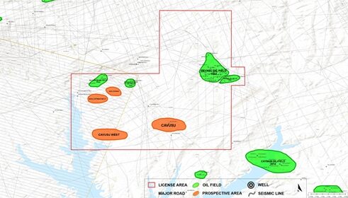
According to recent seismic data interpretations, there are several prospective 4-way closures of different sizes to the West of the Zeynel oil field.